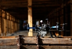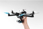
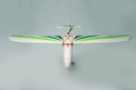
The Aero-M is one of two aerial mapping platforms introduced by 3D Robotics, it is a fixed wing aircraft . It is designed to have everything that you need for mapping straight out of the box and as well as having standard elements includes:
- Pixhawk autopilot system.
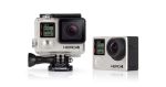
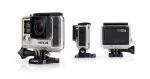
- Canon SX260 with custom 3DR EAI software and fixed mount.
- Pix4Dmapper LT 3DR Edition, which is only capable of creating two-dimensional maps.
- It also includes a custom-designed hard-top travel case.
Additional elements that can be purchased include:
- An upgrade to Pix4Dmapper Pro 3DR Edition, this allows the creation and export of DSM (Digital surface models) and terrain models as well as orthomosaic editing. This costs an extra $5000.
- An OSD (On screen display)/FPV (First person view) system which uses a Sony HAD 520 line camera to stream video to a viewing device while a MinimOSD on-screen-display module superimposes live telemetry data onto the video feed. This costs an additional $249.99. A monitor needs to be purchased to view the data.
It has a 40 minutes flight time and can record up to 250 acres in one flight.
http://store.3drobotics.com/products/aero-m/
The basic price of the Aero-M is $5400, with all of the additions it costs $10724.99. According to 3D Robotics this is providing “advanced mapping capabilities at a price five times less than that of our nearest technological competitor”..


-

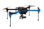
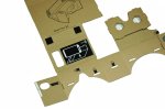
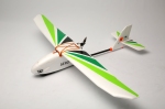
- The 3DRobitics Aero-M fixed-wing drone
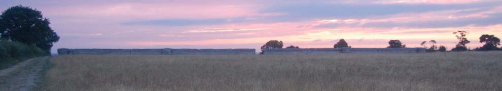
Example
An example of an photo-mosaic map creating using the Pix4Dmapper software from an aerial platform. 
Potential
The flight time of the Aero-M is significantly longer than the other mapping system, X8-M, which demonstrates the benefits of using a fixed wing platform over a multi-rotor platform which needs to power all of the rotors to stay in the air.
The multiple overlapping photographs taken by the camera can be used to create digital elevation models (DEM) these are an important element is archaeological prospection, although they can be created with LIDAR data a much higher level of detail can be generated from those created by photogrammetry using UAV (Unmanned Aerial Vehicle) photographs. The overalapping photographs can also be stitched together to create a high quality mosaic. They can also be used to create a 3D model of the site.
3d Robotics is part of the open-source hardware and software community based at DIY Drones which can help with all aspects of drone construction and use.
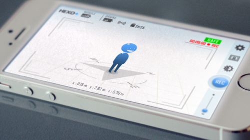
The Pixhawk autopilot system allows the easy creation of a flight path by selecting points on a map displayed in the mission planning software. By selecting a polygon around the area the software can create a grid flight pattern to fly; the altitude, camera type and overlap of images can also be set which alters the amount of times the aerial vehicle flies across the area under study.
Limitations
The problems with using a fixed wing platform for mapping are, takeoffs and landings, and tree cover around the area under study; the X8-M multi-rotor platform has the ability to turn on the spot.
Although the Aero-M is an expensive purchase it appears to still be a bargain.
The extra $5000 for software is also a lot, there are other cheaper options such as Agisoft Photoscan Professional which costs $3499.
It comes with a Canon SX260 camera which is a cheap, compact, lightweight, digital camera that fits well into the system; but it has neither the optics nor the image size (12.1 megapixels vs. 24.2 megapixels) of a higher quality digital SLR camera, so information will be lost from photographs that could be taken by a higher quality camera. The Aero-M platform can carry 500g so it will be able to carry higher specification digital SLR cameras than the Canon, allowing higher definiti0on pictures to be taken.
It is designed solely for mapping so the camera is in a fixed position and can only record downwards.
Although accuracy may have its limitations, by placing targets on the ground in a grid pattern and recording their position with GPS (Global Positioning System) the accuracy can be improved, and as the DEM is accurately georeferenced it can be imported accurately into GIS software.