UAV (Unmanned Aerial Vehicle) photography and photogrammetry has long been a balance between weight and the quality of the camera equipment carried.
Cameras
Low cost camera solutions such as the GoPro can be carried on almost all UAVs because they are small and lightweight, but these benefits are also drawbacks because limited size/fish eye lenses and small image sensors reduce the quality of the photographs they take, together with this the lack of control of many of the camera settings is a drawback.
High quality DSLR (Digital Single Lens Reflex) cameras have superior quality lenses and image sensors together with the fact that they have extensive control of the camera settings meaning that they take much better photographs. But they can only be carried by much higher power/cost octo and hexo-copter systems.
One solution is the lightweight point-and-shoot camera/compact camera used in some mapping solutions, such as those provided by 3DRobotics (Canon PowerShot S100). Although these cameras provide a better quality solution than the GoPro, and may be all that is required for mapping exercises; they are still limited in their optics and higher megapixel sensors which are much more important in the recording of complicated structures and photogrammetry work.
Changes in the camera industry due to competition from the phone industry has enhanced development of a different solution. This is the MILC (Mirrorless Interchangeable-lens camera) or DSLM (Digital Single Lens Mirrorless) Camera. These cameras don’t have the mirror reflex optical viewfinder of a DSLR camera, and the associated weight, replacing it with a LCD screen or with an app on a mobile device which controls the camera. As a result they have the capability to carry high quality interchangeable lenses without the weight associated with DSLR cameras. The system comes in two different forms; the first resembles a standard digital SLR camera, while the second resembles just a lens with all control being provided by an app on a mobile device.
| Camera | Type | Megapixel | Weight | Cost |
| Canon EOS 5D Mark III | Digital SLR | 22.3 | Approx 950g | £2,544 |
| Nikon D5300 | Digital SLR | 24.2 | Approx 840g | £549.99 |
| Sony A5000 DSLM | Digital SLM | 20.1 | Approx 388g | £250 |
| Sony ILCE-QX1 | Lens Style Camera | 20.1 | Approx 332g | £250 |
| Canon PowerShot S100 | Compact Camera | 12.1 | Approx 198g | £195 |
| GoPro Hero3+ Black | Sports Camera | 12 | 74/136g (with housing) | £349.99 |

Canon EOS 5D Mark III

Nikon D5300

α5000 E-mount Camera

ILCE-QX1 Lens-Style Camera
3DRobotics UAV Mapping Solutions, discussed in another blog entry, carry the Canon PowerShot S100 digital compact camera.

Canon PowerShot S100

GoPro Hero3+ Black
UAVs
UAVs come in a number of different configurations and increase in price with a higher level of complexity and ability to carry heavier loads.
| UAV | Type | Payload Capacity | Price (Without Gimbal) |
| 3D Robotics Iris+ | Quadcopter | 400g | £599 |
| 3D Robotics X8+ | Octocopter | 800g – 1Kg with reduced flight time | £880 |
| Spreading Wings S900 | Hexacopter | 4.7 – 8.2Kg | £1,291-£1,540 |
| DJI Spreading Wings S1000+ | Octocopter | 11Kg | £1,750-£2,057 |

3D Robotics Iris+ Quadcopter

3D Robotics X8+ Octocopter
Gimbals
Gimabls are an important element in stabilizing cameras during photography and video recording, as well as providing a motorized solution to move the camera to a desired angle during flight. They can add significantly to both the weight and price of any UAV solution depending on the camera equipment they are carrying.
| Gimbal | Camera | Weight (Camera excluded) | Cost |
| DJI Zenmuse H4-3D | GoPro | 168g | £249 |
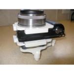
| DYS 3 axis brushless gimbal | Sony NEX size camera | 388g | £231.95 – £299.94 |
| DJI Zenmuse Z15-A7 | Sony α7s and α7r | 1.3Kg | £1,915 |
| DJI Zenmuse Z15-5D III (HD) | Canon EOS 5D DSLR | 1.53Kg | £2,831 |
Solutions
The 3DRobotics Iris+ Quadcopter has a payload capacity of 400g which would allow a rather small 15g for a mount to attach a Sony A5000 DSLM or 68g to attach a Sony QX1 Lens-Style Camera without weighing too much, although the system could be flown with excess weight reducing the flight time. A downward facing 3D Printed Sony A5000 Mapping Mount is available for both the Iris+ Quadcopter and X8+ Octocopter, it weighs 36g.
-

- Sony α5000 Mount

Although the X8+ is a octocopter by definition, it gets over the intrinsic problems of size, weight and cost caused by eight separate arms by having two rotors on each arm, one pointing up and the other downwards. With a maximum payload of 1KG it can carry a Sony A5000 DSLM camera (388g) together with a gimbal such as the DYS 3 Axis Brushless Gimbal for Sony NEX size cameras (609g) to support and move it, the gimbal is designed for the NEX range of cameras, but they are almost identical to the A5000 in design. Although a lighter mount could be used.

3 Axis Brushless Gimbal for Sony Nex size cameras
Conclusions
The mirror-less camera would seem to provide a solution to the problem of how to carry a high specification camera capable of capturing high quality images on a fairly low-cost UAV solution.
Sources
http://en.wikipedia.org/wiki/Mirrorless_interchangeable-lens_camera
http://www.dummies.com/how-to/content/gopro-cameras-understand-the-cameras-limitations.html
http://dronebly.com/quadcopter-vs-hexacopter-vs-octocopter-the-pros-and-cons