Tag Archives: dji

News – UK Drone Show 2016

New Drones

DJI

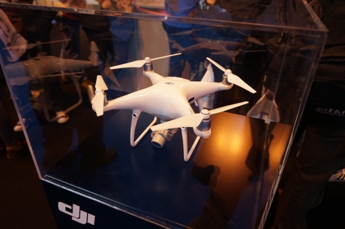
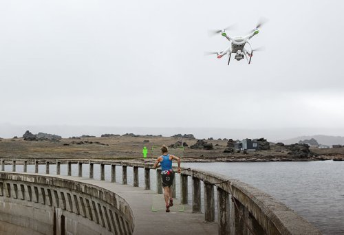
The DJI stand held two of their new models.

The Mavic Pro is a portable system with collapsible arms allowing it to fit into a small backpack. Its’ FlightAutonomy technology allows obstacle avoidance and hover precision, while ActiveTrack allows the drone to follow the subject matter with a number of different shooting modes. It comes with a 3-axis gimbal and 4K camera.

It is available for pre-order for £1,099.

The Phantom 4 Pro is an upgrade of the Phantom 4 . It improves on a number of areas of the previous drone:

  • Improved camera with a 1-inch 20 megapixel sensor from a 1/2.3 inch 12.3 megapixel sensor on the Phantom 4.
  • Stereo vision sensors on the rear of the drone in addition to the front facing ones that were on the original.
  • New infrared sensors on the left and right of the drone.
DJI Phantom 4 Pro

DJI Phantom 4 Pro

The Phantom 4 Pro costs £1,589, while a version where the remote controller has an integrated screen costs £1,819.

Yuneec

A new combined thermal and RGB camera for the Typhoon H drone was available.

The camera costs £1,799.

New Technologies

A number of technologies under development were on view in the Innovation Zone.

Tetradrone

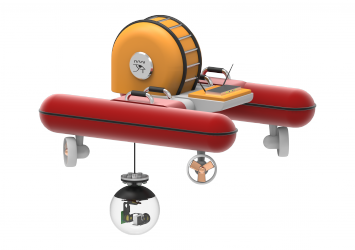
An interesting concept of combined drone and submersible, changing the type of propeller allows the drone to either fly or go underwater with the body being watertight.

www.tetradrones.co.uk

http://jgarnham94.wixsite.com/tetra

https://www.facebook.com/TetraDrones/?hc_ref=SEARCH

Tetra Drone

Tetra Drone

Available for funding soon on Kickstarter.

Seadrone

An innovative modular underwater drone by van Dijk FEM engineering B.V. with a camera and a crab module for removing material from the sea bed.

http://seadrone.nl/

https://www.facebook.com/SeaDroneNL

SeaDrone

SeaDrone

Droneball

Another innovative technology was droneball, which was a drone fully enclosed in a cage stabilizing system which protects the drone and its surroundings from damage as it flies around, it either fly or roll along the ground.

DroneBall

DroneBall

The droneball is getting launched on indiegogo on the 8th of December.

https://www.indiegogo.com/projects/droneball-the-bouncing-crash-resistant-drone-drones/coming_soon


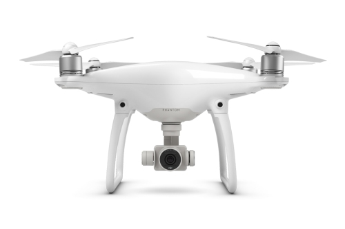
DJI Phantom 4

The DJI Phantom 4 is the new model in the popular phantom range of quadcopters, it has a number of improvements over previous models.

DJI Phantom 4

DJI Phantom 4

Comparison of DJI Phantom 4 and 3

Model Phantom 4 Aircraft Phantom 3 Professional or Advanced Aircraft
Battery 4S 15.2V 5350mAh Intelligent Flight Battery 4S 15.2V 4480mAh Intelligent Flight Battery
Max Flight Time 28 mins About 23 mins
Vision Positioning System 10m 3m
Obstacle Sensing System Optical Sensor – 0.7 – 15m N/A
Intelligent Flight Modes Follow Me
Point of Interest
Waypoints
Course Lock
Home Lock
ActiveTrack
TapFly
Follow Me
Point of Interest
Waypoints
Course Lock
Home Lock

Using the TapFly mode you can tap on a position of the screen in the app to fly to that location.

One of its main improvements is the introduction of obstacle avoidance technology (Sense and Avoid) using cameras mounted above the legs on the front of the Phantom 4.
DJI Phantom 4 - Obstacle Avoidance

DJI Phantom 4 – Obstacle Avoidance

The system, and the subsequent technologies, rely on a companion computer within the drone attached to the various sensors which uses computer vision algorithms to detect obstacles in the drones path. Once it has detected an obstacle it will either hover or fly around it.

DJI Phantom 4 - Companion Computer

DJI Phantom 4 – Companion Computer

It also comes with an improved Vision Positioning System, for position hold without the aid of GPS, which raises the positioning altitude from 3m to up to 10m.

DJI Phanton 4 - Vision Positioning

DJI Phanton 4 – Vision Positioning

A final important new technology is ActiveTrack where a subject can be selected in the app, and once again using computer vision technologies, the Phantom 4 will follow the subject even when it is turning.

DJI Phantom 4 - Active Track

DJI Phantom 4 – Active Track

The DJI Phantom 4 is available for £1,229.00 and will be on general release from the 23rd of March. As such it will be the first commercially available drone with obstacle avoidance technology.

Benefits

The Phantom 4 provides a number of cutting edge technologies on a low cost platform. The benefit of ActiveTrack has already been discussed in a previous blog – UAVs for site tour recording – Part 1 – Theory while the potential of the sense and avoid and vision positioning system technologies will be discussed in a future blog on building recording.

Drawbacks

The main drawback of the system is the fact that the camera is not of the same quality as the Zenmsue X5 which is available for the DJ Inspire 1 Pro/Raw. But even this camera is not of the same specifications as many standard DSLR or mirrorless cameras, only providing 16MP.

UAVs for site tour recording – Part 1 – Theory

Thanks to UAVs there is a growing potential for the provision of high quality visualizations of sites from the air for public consumption; whether as part of the requirement of many archaeology companies as charities, as part of planning policies to interact with the public, or the growing importance of crowdfunding archaeological excavations (DigVentures) which require interaction with their backers. UAVs can provide a means of providing this sort of imagery as part of an overall recording strategy. This includes the recording of site tours which can provide details of a sites which can easily be disseminated to the public.

At its simplest the UAV can provide an aerial element to the video of the site tour by flying past or through elements of the site or flying past or hovering in front of the site tour guide.

The DJI Inspire 1 is one such aerial video platform which can be purchased with two remote controllers; one for controlling the UAV, while the other is used to control the camera gimbal. This allows a pilot to fly the UAV on a set path while someone experienced in film making has complete control of the camera.

DJI Inspire 1

DJI Inspire 1

Although the UAV can provide an excellent platform for aerial video recording as part of site tours, recently developed technologies can make this much more automated and provide a means for one person to both:

  1. The site tour guide.
  2. The UAV pilot recording the site tour.

There are two ways in which this can be done.

1. GPS ‘Follow Me’ technology

'Follow Me' technology (DroneDog using Pixhawk)

‘Follow Me’ technology (DroneDog using Pixhawk)

This functionality is available on many UAVs, including some of the DJI series and those using the open source PX4 and Pixhawk autopilot technologies.

With the PX4/Pixhawk systems the mode can be controlled from a number of base station software solutions including Tower, which can run on Android mobile devices such as smartphones.

The systems uses the GPS of the mobile device as a target for the UAV.

A number of cinematic controls for the UAV are available in the app:

  • Leash – UAV follows actor.
  • Lead – UAV leads actor pointing back at them.
  • Left/Right – UAV keeps pace with actor to the side.
  • Circle – UAV circles actor at specified radius.
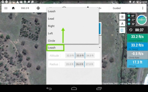
'Follow Me' controls (3DR Tower)

‘Follow Me’ controls (3DR Tower)

The following parameters can also be set:

  • Altitude.
  • Radius.
3DR Tower - Altitude and Radius

3DR Tower – Altitude and Radius

The system also controls the camera gimbal, pointing the camera towards the GPS enabled device.

Together these controls can provide various aerial video elements useful for integration in a site tour video which can be controlled directly from the mobile device in the hand of the site tour guide.

2.Computer vision technologies

Computer Vision technologies are an important developing area in robotics and are beginning to be fitted to UAVs.

Some of these technologies use image recognition algorithms to match the subject matter between consecutive video frames allowing the UAV to follow a person or object even when it is rotating and so changing the way it appears.

They come in three forms:

A. Software

Currently in beta testing the Vertical Studio app (available on iOS and Android) uses existing camera hardware on the DJI Phantom 3 or Inspire to provide the imagery for the image recognition algorithms running in the app. A target is chosen in the app which then controls the flight of the UAV.

Vertical Studio App

Vertical Studio App

You can also draw walls in the app that designate no fly areas for the UAV.

Walls in the Vertical Studio App

Walls in the Vertical Studio App

B. Add-on technology

The second is an add-on technology that is fitted to an existing UAV, which connects to the autopilot and controls the flight of the UAV. In the case of the Percepto (funded on the Indiegogo crowdfunding website) the processing is done in a companion computer while the video is taken from an add-on camera, controls are then sent to the autopilot and gimbal to control the movement of them in relation to the subject matter.
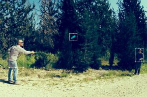
Percepto Tracking

Percepto Tracking

Percepto Kit

Percepto Kit

C. Integrated technology

The third is an an integral part a newly built UAV, but is in effect a very similar technology to B.

This is the case with the soon to be released DJI Phantom 4, which is the first commercially available UAV with the technology integrated into it.


The app connects to a companion computer on the UAV which uses the imagery from the camera as a source for the computer vision algorithms. Once again the subject matter is selected in the app and the UAV will follow it.

Phantom 4 App

Phantom 4 App


Sources
https://3dr.com/kb/follow-instructions/

http://www.dji.com/product/phantom-4

http://www.dji.com/product/intelligent-flight-modes

http://vertical.ai/features/

http://www.percepto.co/

Mirror-less Cameras and UAVs

UAV (Unmanned Aerial Vehicle) photography and photogrammetry has long been a balance between weight and the quality of the camera equipment carried.

Cameras

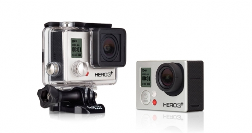
Low cost camera solutions such as the GoPro can be carried on almost all UAVs because they are small and lightweight, but these benefits are also drawbacks because limited size/fish eye lenses and small image sensors reduce the quality of the photographs they take, together with this the lack of control of many of the camera settings is a drawback.

High quality DSLR (Digital Single Lens Reflex) cameras have superior quality lenses and image sensors together with the fact that they have extensive control of the camera settings meaning that they take much better photographs. But they can only be carried by much higher power/cost octo and hexo-copter systems.

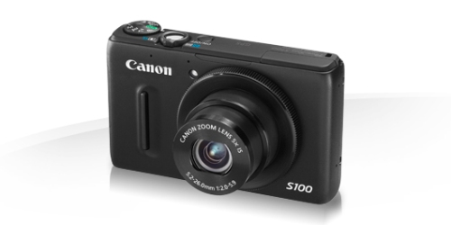
One solution is the lightweight point-and-shoot camera/compact camera used in some mapping solutions, such as those provided by 3DRobotics (Canon PowerShot S100). Although these cameras provide a better quality solution than the GoPro, and may be all that is required for mapping exercises; they are still limited in their optics and higher megapixel sensors which are much more important in the recording of complicated structures and photogrammetry work.

Changes in the camera industry due to competition from the phone industry has enhanced development of a different solution. This is the MILC (Mirrorless Interchangeable-lens camera) or DSLM (Digital Single Lens Mirrorless) Camera. These cameras don’t have the mirror reflex optical viewfinder of a DSLR camera, and the associated weight, replacing it with a LCD screen or with an app on a mobile device which controls the camera. As a result they have the capability to carry high quality interchangeable lenses without the weight associated with DSLR cameras. The system comes in two different forms; the first resembles a standard digital SLR camera, while the second resembles just a lens with all control being provided by an app on a mobile device.

Camera Comparison
Camera Type Megapixel Weight Cost
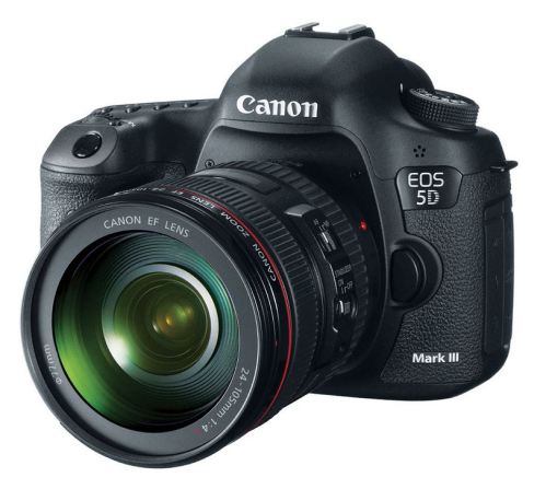
Canon EOS 5D Mark III Digital SLR 22.3 Approx 950g £2,544
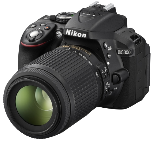
Nikon D5300 Digital SLR 24.2 Approx 840g £549.99
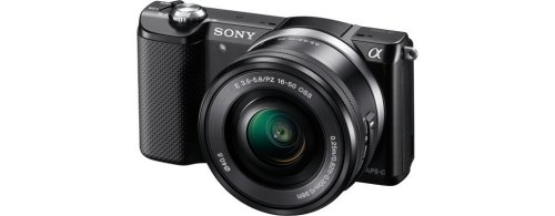
Sony A5000 DSLM Digital SLM 20.1 Approx 388g £250
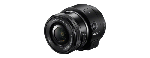
Sony ILCE-QX1 Lens Style Camera 20.1 Approx 332g £250
Canon PowerShot S100 Compact Camera 12.1 Approx 198g £195
GoPro Hero3+ Black Sports Camera 12 74/136g (with housing) £349.99
Canon EOS 5D Mark III

Canon EOS 5D Mark III

Nikon D5300

Nikon D5300

α5000 E-mount Camera

α5000 E-mount Camera

ILCE-QX1 Lens-Style Camera

ILCE-QX1 Lens-Style Camera

3DRobotics UAV Mapping Solutions, discussed in another blog entry, carry the Canon PowerShot S100 digital compact camera.

Canon PowerShot S100

Canon PowerShot S100

GoPro Hero3+ Black

GoPro Hero3+ Black

UAVs

UAVs come in a number of different configurations and increase in price with a higher level of complexity and ability to carry heavier loads.

UAV Comparison
UAV Type Payload Capacity Price (Without Gimbal)
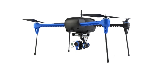
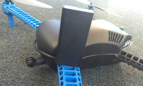
3D Robotics Iris+ Quadcopter 400g £599
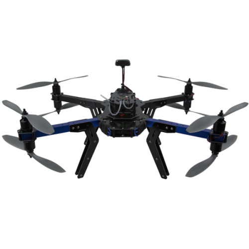
3D Robotics X8+ Octocopter 800g – 1Kg with reduced flight time £880
Spreading Wings S900 Hexacopter 4.7 – 8.2Kg £1,291-£1,540
DJI Spreading Wings S1000+ Octocopter 11Kg £1,750-£2,057
3D Robotics Iris+ Quadcopter

3D Robotics Iris+ Quadcopter

3D Robotics X8+ octocopter

3D Robotics X8+ Octocopter

Gimbals

Gimabls are an important element in stabilizing cameras during photography and video recording, as well as providing a motorized solution to move the camera to a desired angle during flight. They can add significantly to both the weight and price of any UAV solution depending on the camera equipment they are carrying.

Gimbal Price Comparison
Gimbal Camera Weight (Camera excluded) Cost
DJI Zenmuse H4-3D GoPro 168g £249
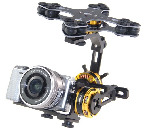
DYS 3 axis brushless gimbal Sony NEX size camera 388g £231.95 – £299.94
DJI Zenmuse Z15-A7 Sony α7s and α7r 1.3Kg £1,915
DJI Zenmuse Z15-5D III (HD) Canon EOS 5D DSLR 1.53Kg £2,831

Solutions

The 3DRobotics Iris+ Quadcopter has a payload capacity of 400g which would allow a rather small 15g for a mount to attach a Sony A5000 DSLM or 68g to attach a Sony QX1 Lens-Style Camera without weighing too much, although the system could be flown with excess weight reducing the flight time. A downward facing 3D Printed Sony A5000 Mapping Mount  is available for both the Iris+ Quadcopter and X8+ Octocopter, it weighs 36g.

Although the X8+ is a octocopter by definition, it gets over the intrinsic problems of size, weight and cost caused by eight separate arms by having two rotors on each arm, one pointing up and the other downwards. With a maximum payload of 1KG it can carry a Sony A5000 DSLM camera (388g) together with a gimbal such as the DYS 3 Axis Brushless Gimbal for Sony NEX size cameras (609g) to support and move it, the gimbal is designed for the NEX range of cameras, but they are almost identical to the A5000 in design. Although a lighter mount could be used.

3 Axis Brushless Gimbal for Sony NEX size cameras

3 Axis Brushless Gimbal for Sony Nex size cameras

Conclusions

The mirror-less camera would seem to provide a solution to the problem of how to carry a high specification camera capable of capturing high quality images on a fairly low-cost UAV solution.

Sources

http://en.wikipedia.org/wiki/Mirrorless_interchangeable-lens_camera

http://www.dummies.com/how-to/content/gopro-cameras-understand-the-cameras-limitations.html

http://www.japantimes.co.jp/news/2013/12/30/business/mirrorless-cameras-offer-glimmer-of-hope-to-makers/

http://dronebly.com/quadcopter-vs-hexacopter-vs-octocopter-the-pros-and-cons

DJI Inspire 1

The DJI Inspire 1 is the new quadcopter by the DJI company, this company is at the forefront of commercial innovations in UAV technology and the Inspire 1 brings a number of new technologies to the market.

One of these innovative design elements is that the rotors and legs can be lifted during flight allowing a full, unrestricted 360⁰ below the camera, this unrestricted view is common in much more expensive systems.

An option that is used in professional videography is dual-operator control, this is where one operator flies the UAV while the other controls the camera via the gimbal controls, with each operator having their own screen. The Inspire 1 has this option with the ability to buy two remote controls with the system as well as the technology within the drone.

Another innovative technology is the Optical Flow Technology which allows the location and altitude of the Inspire 1 to be maintained accurately even when a GPS signal is not available, such as an indoor environment, and allows the legs to automatically be lowered when landing. While the Vision Positioning System allows the system to hold its position while indoors, stop when the controls are released, and respond to your commands using a camera and ultrasonics system.

The DJI mobile app is available on iOS and Android and allows manual control of the camera, provides flight telemetry data and auto takeoff and landing controls.

The DJI Inspire 1 specifications are:

  • Hovering accuracy with the GPS mode of 0.5m vertical and 2.5m horizontal
  • Maximum Angular Velocity – Pitch: 300°/s and Yaw: 150°/s
  • Maximun Tilt Angle: 35°
  • Maximum Ascent Speed: 5m/s
  • Maximum Descent Speed: 4m/s
  • Maximum Speed: 22m/s (ATTI mode, no wind)
  • Maximum Flight Altitude: 4500m
  • Maximum Wind Speed Resistance: 10m/s
  • Maximum Flight Time: Approximately 18 minutes

The camera specifictions are:

  • 12 megapixel photographs
  • Video in 4K at 24-30 fps, or 1080p at 24-60fps
  • Lens with 9 elements in 9 groups including an aspherical element
  • 1/2.3 inch CMOS sensor
  • 94⁰ wide-angle FOV (Field of view)
  • 3-axis, 360⁰ rotating gimbal

The video from the camera can be displayed in real-time in 720p HD on mobile devices thanks to DJI’s Lightbridge technology which can transmit video up to 2km.

The modular payload systen of the Aspire 1 suggested that there are planned options for other recording media.

The camera can be detached and attached to a pole making the camera a handheld recording device.

A SDK (Software DEvelopment Kit) has allowed outside company integration with both the camera and software.

The Inspire 1 costs £2,380 with one remote control and £2,749 with two remote controls.

Potential
The Inspire 1 is a complete ready to fly system.

A constant problem with cheaper UAV systems is the fixed nature of the camera, with gimbals only being able to pan up and down generally because of the position of the legs of the vehicle. More expensive systems have legs that can be lifted upwards by motors allowing the camera to move 360° from side to side meaning that a separate camera operator can control the camera while the pilot concentrates on the flying, but these tend to be very expensive (£5000-7000 or more) and still require the additional purchase of a camera. The Inspire 1 gets around this problem by designing a system which lifts the legs up at the same time as the props giving this 360° degree field of view.

The Optical Flow Technology allows the Inspire 1 to fly indoors with stability when there is no GPS signal to stabilize the system.

Thanks to these abilities the Inspire 1 has the ability to both map archaeology and cultural heritage by taking vertical overlapping photographs from above in a mapping pattern, to record upstanding monuments with the camera at a right angle to them, and to record flythroughs of both archaeology and cultural heritage with a separate controller panning the camera when required. Unlike other systems it provides all of these abilities in one package.

The ability to carry other recording packages in the future is very enticing, hopefully including lidar and infra-red.

Limitations
On the face of it the cost would seem too high, but after analysing what you get (see the article on RC Geeks), for full details it becomes quite reasonable.

  • It comes with the DJI Lightbridge technology which would cost an additional £999 is purchased separately.
  • To equip a previous UAV with the 4K camera technology would require the purchase of a GoPro Hero4 Black which costs £369.99.
  • The Zenmuse H3-3D Gimbal to hold the camera would cost an additional £249.

So even buying the DJI Phantom 2 for £499 the additional costs to provide similar abilities to the Inspire 1 bring it close to the cost of that system, and that is without many of the abilities that the Inspire 1 has.

Although the Inspire 1 is pricey it comes with everything that you could need for professional style photography.

With the incareased movement of the many elements of the Inspire 1 there may be problems with wear and tear on the system.

News – GoPro to develop drones

The Wall Street Journal has announced that GoPro, a company known for creating cameras aimed at the extreme sports industry, are going to begin to develop multi-rotor UAVs (Unmanned Aerial Vehicles).

GoPro already provide many of the cameras that are used in UAVs including many of those supplied by DJI (The leading UAV manufacturer) and 3D Robotics Inc, although their recent mapping systems have moved away from the GoPro camera instead using the Canon SX260.

Competition provided by the Sony Corporation and their Action Cam AS100V, and the move by DJI to using in-house developed cameras in their new Inspire 1 system, may be a reason for development of the GoPro company into new areas.

It is believed that the systems will have a price tag of between $500 and $1,000 and will be available in late 2015.

DJI SDK (Software Development Kit)

DJI Innovations has released a SDK (Software Development Kit) which allows developers and pilots access to the inner workings of some of their UAVs (Unammed Aerial Vehicles).

The SDK is designed to integrate with the DJI Phantom Vision and Vision+ via iOS and Android apps at a greater level than with the controller. It provides access to the camera, long range video downlink, gimbal, flight status system, battery, Wi-Fi range extender, secure Wi-Fi transmission, GPS information, telemetry information and flight control data.

The SDK comes in levels 1 and 2. Level 2 adds abilities linked to the ground station and flight control allowing long range piloting complete with route planning and full flight telemetry allowing complete control of the flight of the UAV, what the camera does and what happens to the images once they have been taken.

It does not work with the standard Phantom 2 quadcopters as the gimbal and camera do not come with the system so are not controlled in the same way.

Business Partners

The Software Development Kit has already allowed collaboration between a number of business partners.

Pix4D
Pix4d are a software company that is one of the leading providers of UAV photogrammetry processing software; they have developed an app that allows the user to configure an automatic mapping flight pattern for the DJI Phantom Vision+. The area to map and height are set and the software calculates when to capture images with the camera for the optimal capture of the area under study. The app then guides the user in how to best process the images using the Pix4Dmapper software.

The images taken are automatically tagged and geo-tagged.

The BETA version of the software is currently free only for Android devices on the app store, although an iOS will also be available soon. It supports the DJI Phantom Vision+ with support for other UAV systems being added later.

Drone Deploy
Drone Deploy have used the SDK to allow the integration of the UAV into the already existing DroneDeploy mapping system. This system allows the the control a whole fleet of UAVs remotely via a web interface, using a map interface to determine the area to be recorded together with camera type and other information, it even takes into consideration wind speed.

Photographs are automatically uploaded to the cloud and processed into 3D models, Digital Elevation Models and Orthophotos. If an out of focus photograph is detected the UAV can automatically refly this part. The system can also integrate with other recording sensor systems.

DroneDeploy is compatible with many different UAV systems but  other systems can be upgraded to use the system by adding a DroneDeploy CoPilot.

Screenshot 2015-01-29 11.24.38

DroneDeploy CoPilot

PixiePath

PixiePath‘s Drone Fleet Management Platform is a cloud-based system which can build complex drone applications, managing the coordinated movement and activities of fleets of UAVs in real time.

Pixiepath

PixiPath System Diagram


Field of View
Field of View offers a multispectral mapping payload for the DJI Phantom 2 and is increasingly its integration with the Phantom via a customized app.