Tag Archives: video

UAVs for site tour recording – Part 1 – Theory

Thanks to UAVs there is a growing potential for the provision of high quality visualizations of sites from the air for public consumption; whether as part of the requirement of many archaeology companies as charities, as part of planning policies to interact with the public, or the growing importance of crowdfunding archaeological excavations (DigVentures) which require interaction with their backers. UAVs can provide a means of providing this sort of imagery as part of an overall recording strategy. This includes the recording of site tours which can provide details of a sites which can easily be disseminated to the public.

At its simplest the UAV can provide an aerial element to the video of the site tour by flying past or through elements of the site or flying past or hovering in front of the site tour guide.

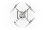
The DJI Inspire 1 is one such aerial video platform which can be purchased with two remote controllers; one for controlling the UAV, while the other is used to control the camera gimbal. This allows a pilot to fly the UAV on a set path while someone experienced in film making has complete control of the camera.

DJI Inspire 1

DJI Inspire 1

Although the UAV can provide an excellent platform for aerial video recording as part of site tours, recently developed technologies can make this much more automated and provide a means for one person to both:

  1. The site tour guide.
  2. The UAV pilot recording the site tour.

There are two ways in which this can be done.

1. GPS ‘Follow Me’ technology

'Follow Me' technology (DroneDog using Pixhawk)

‘Follow Me’ technology (DroneDog using Pixhawk)

This functionality is available on many UAVs, including some of the DJI series and those using the open source PX4 and Pixhawk autopilot technologies.

With the PX4/Pixhawk systems the mode can be controlled from a number of base station software solutions including Tower, which can run on Android mobile devices such as smartphones.

The systems uses the GPS of the mobile device as a target for the UAV.

A number of cinematic controls for the UAV are available in the app:

  • Leash – UAV follows actor.
  • Lead – UAV leads actor pointing back at them.
  • Left/Right – UAV keeps pace with actor to the side.
  • Circle – UAV circles actor at specified radius.
'Follow Me' controls (3DR Tower)

‘Follow Me’ controls (3DR Tower)

The following parameters can also be set:

  • Altitude.
  • Radius.
3DR Tower - Altitude and Radius

3DR Tower – Altitude and Radius

The system also controls the camera gimbal, pointing the camera towards the GPS enabled device.

Together these controls can provide various aerial video elements useful for integration in a site tour video which can be controlled directly from the mobile device in the hand of the site tour guide.

2.Computer vision technologies

Computer Vision technologies are an important developing area in robotics and are beginning to be fitted to UAVs.

Some of these technologies use image recognition algorithms to match the subject matter between consecutive video frames allowing the UAV to follow a person or object even when it is rotating and so changing the way it appears.

They come in three forms:

A. Software

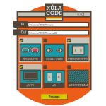
Currently in beta testing the Vertical Studio app (available on iOS and Android) uses existing camera hardware on the DJI Phantom 3 or Inspire to provide the imagery for the image recognition algorithms running in the app. A target is chosen in the app which then controls the flight of the UAV.

Vertical Studio App

Vertical Studio App

You can also draw walls in the app that designate no fly areas for the UAV.

Walls in the Vertical Studio App

Walls in the Vertical Studio App

B. Add-on technology

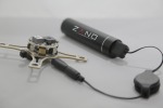
The second is an add-on technology that is fitted to an existing UAV, which connects to the autopilot and controls the flight of the UAV. In the case of the Percepto (funded on the Indiegogo crowdfunding website) the processing is done in a companion computer while the video is taken from an add-on camera, controls are then sent to the autopilot and gimbal to control the movement of them in relation to the subject matter.

Percepto Tracking

Percepto Tracking

Percepto Kit

Percepto Kit

C. Integrated technology

The third is an an integral part a newly built UAV, but is in effect a very similar technology to B.

This is the case with the soon to be released DJI Phantom 4, which is the first commercially available UAV with the technology integrated into it.


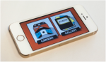
The app connects to a companion computer on the UAV which uses the imagery from the camera as a source for the computer vision algorithms. Once again the subject matter is selected in the app and the UAV will follow it.

Phantom 4 App

Phantom 4 App


Sources
https://3dr.com/kb/follow-instructions/

http://www.dji.com/product/phantom-4

http://www.dji.com/product/intelligent-flight-modes

http://vertical.ai/features/

http://www.percepto.co/

Brushless Gimbals – Part 1 – Introduction

Camera Gimbals
Camera Gimbals are used for many different things in many different industries including stabilizing cameras for TV/Cinema. Their development can be traced from the introduction of the Steadicam in the 1970’s. This allowed the stabilized movement of a camera, revolutionizing filming by removing the need for a wheeled Camera Dolly running on expensive/time consuming tracks or leveled boards. Although the system is not motorized it introduced the principal of a stabilized camera.

Recent technological developments have allowed the construction of lightweight/low cost motorized gimbal systems which can be carried by UAVs.

Gimbals and Archaeological/Heritage recording
With the development of the UAV the development of a lightweight camera gimbal to enable it to carry stabilized cameras was also begun.

The gimbal has become an important element in UAV photographic/video recording, from taking vertical photographs for mapping purposes to cinematic style flypasts/throughs of buildings.

Mapping can be undertaken with cameras attached to the UAV with a static mount, but this removes the ability to use the camera for other recording methods without landing the UAV and changing the mount.

3D Printed UAV Mapping Mount

3D Printed UAV Downward Facing Mapping Mount

Although this series of blogs will concentrate on UAV camera gimbals,  much of what is discussed is transferable to other recording platforms/techniques.

There are also other recording systems that use gimbals which could aid in recording; including handheld GoPro systems such as the EasyGimbal Kickstarter Project.

EasyGimbal handheld GoPro Gimabl

EasyGimbal handheld GoPro Gimbal

Some of these types of systems, such as the FY G4 handheld gimbal, can be attached to extensions poles allowing low altitude aerial photography/video to be undertaken using a handheld remote control to rotate the gimbal.

FY Reach extension pole with FY G4 3-xis handheld gimbal

FY Reach extension pole with FY G4 3-xis handheld gimbal

Gimbals can also provide a stabilized camera platform on rovers such as the Flyoxis Buggy Cam allowing the recording of ceilings and tunnels.

Flyonix Buggy Cam

UAV camera gimbals

UAV camera gimbals are designed to:

1. Remove camera vibration using the anti-vibration rubber balls within the gimbal frame.
2. Stabilize the camera as the UAV moves, keeping it level and pointing in the required direction.
3. Allow the movement of the camera to point at the subject matter while flying the UAV, sometimes in completely different directions.

Types of gimbal

Gimbals come in two different types:

1. The two-axis gimbal.
2. The three-axis gimbal.

Two-axis gimbals are designed for UAVs where there is no requirement to pan the camera from left to right, such as those with fixed landing gear which precludes the panning of cameras whether physically or visually.

Zenmuse H3-2D 2-Axiz Gimbal on a DJI Phantom 2

There are many different gimbals for numbers of different camera, from GoPros through mirrorless cameras to Digital SLR cameras.

Some of these can be purchased already constructed and calibrated out of the box, such as the Zenmuse Gimbals supplied by DJI Innovations. Others come ready installed on a UAV. While the one I will be discussing is a DIY kit which needs to be built and setup.

The price difference between buying a ready made solution and building your own one from a kit in order to carry the same camera can can be quite significant:

Model Camera Price
DYS BLG3SN 3-Axis Brushless Gimbal with BaseCam SimpleBGC 32-bit controller Sony NEX size camera £299.94
Zenmuse Z15 Sony NEX 5 and 7 £1,915.00

Components
The brushless gimbal is made up of a number of different components:

  • Gimbal frame
  • Gimbal controller
  • IMU (Inertial Measurement Units)
  • Brushless Motors
  • Battery
  • Camera
Gimbal Frame

Gimbal frames are deigned for different types of cameras. The gimbal frame I am using for this project is the DYS BLG3SN 3-Axis Brushless Gimbal Frame kit with 3pcs BGM4108-130 Brushless Motors for the SONY NEX type of camera. I will be using a Sony α5000 Mirrorless Camera which is almost identical to the NEX series cameras.

DSC00792

DYS 3 Axis Brushless Gimbal

Gimbal Controller

In order to control the gimbal a gimbal controller board is required, there are a number available on the market. The Zenmuse gimbals supplied by DJI Innovations are designed to connect directly into the DJI UAV, while other  solutions require a separate board.

The gimbal controller board one I am using is the BaseCam SimpleBGC 32-bit board which is designed for 3-axis gimbals. The cheaper and simpler BaseCam (AlexMos) SimpleBGC (formerly called AlexMos) although designed for 2-axis gimbals can be upgraded to support 3-axis gimbals with the addition of an extension board. The 32-bit board is a lot easier to use as well as being more up-to-date and so was chosen as a first gimbal construction experiment.

Basecam SimpleBGC 32 Bit Gimbal Controller with IMU attached

IMU (Inertial Measurement Unit)

Another important element is the IMU , in the case of this 3-axis gimbal two of these are required. One is connected to the main frame of the camera gimbal while the other is connected to the camera mount. These tell the gimbal controller which direction the gimbal/camera is pointing and the gimbal controller can then control the motors to point the camera in the required direction.

IMU attached to gimbal frame

Brushless Motors

The importance of brushless motors in the development of lightweight/high-powered UAV systems has already been discussed in another blog.

Those in gimbals are slightly different, rather than being designed to spin quickly they are designed to hold the camera in position with enough torque to stop it moving and also to rotate to level the camera when required.

In the case of a 3-axis gimbal one motor is required for each of the 3 axis.

DSC00798

Brushless Gimbal motor

Although originally it was required to rewind the wires inside motors designed for the rotor blade with thinner wires to increase the motor resistance and torque, it is now possible to buy ready made motors for the purpose. These motors come in different sizes depending on the size of the camera they are required to stabilize.

Calibration
In order to use the gimbal it needs to be calibrated. This is done using the OpenSource SimpleBCG program. The is installed either as a Windows program or Android app and the gimbal is calibrated using the USB port on the gimbal controller board.

Detailed instructions on how to do this can be found in many places including YouTube videos.

In the case of a 3-axis gimbal two IMUs need to be calibrated, one for the camera and the other for the gimbal frame.

SimpleBCG Gimbal Calibration Software

A triple axis camera spirit level can be used to accurately calibrate the two IMUs.

DSC00918

Camera Triple Axis Spirit Level

A number of other settings can be altered in order that the gimbal works as required.

3 Axis Brushless Gimbal for Sony NEX size cameras

3 Axis Brushless Gimbal for Sony NEX size cameras

Once the gimbal controller has been calibrated the camera will remain in place as the gimbal is moved around it. This is done by calibrating the IMUs to a nominal position, the IMUs determine the actual position of the gimbal and the motors are turned on to correct the position, less voltage is sent to the motors the closer to the nominal position that the gimbal is.

Sources
http://www.simplebgc.com/eng/

http://www.simplebgc.org/

http://www.unmannedtechshop.co.uk/3-axis-brushless-gimbal-sony-nex-size-camera/

http://www.unmannedtech.co.uk/manualsguides/blg3sn-brushless-gimbal-assembly-guide

http://www.dronetrest.com/t/how-to-connect-and-setup-alexmos-3-axis-brushless-gimbal-controller/53

http://www.dronetrest.com/t/balancing-your-brushless-gimbal/55

https://en.wikipedia.org/wiki/Gimbal

PlexiDrone

The PlexiDrone is an Indiegogo drone project aimed at film makers and aerial photographers.

The system comes in two different configurations; the x4 has four rotors while the x8 has 8, four above and four below. As a result they have different flight characteristics.

  • Flight time – 25 mins x4, 20 mins x8
  • Speed – 37 mph x4, 42mph x8
  • Thrust – 2.35 kg x4, 4.1 kg x8

It’s other specifications include:

  • Follow me technology
  • Retractable landing gear allowing an unobstructed view below the drone enabling a 360˚ camera gimbal
  • SwarmTech allowing multiple drones to be controlled and film the same subject matter
  • Object avoidance using ultrasonic sensors which can sense up to 32 ft. (10 m)
  • The market version will include a bottom facing ultrasonic sensor which will help control altitude and lower the landing gear when required
  • It will also include a front-facing and bottom facing optical flow sensor helping with stability when indoors and without a GPS signal
  • The PlexiDrone allows modular payloads including:
    1. PlexiDrone 3D Gimbal which carries a GoPro
      PlexiCinema 3D Gimbal which carries mirror-less cinema-quality cameras like the Sony A5000, Sony RX100 III, and Lumix GM5
      Bubl 360˚ Camera
      Sony ActionCam
  • PlexiGCS control App on iOS, Android or Windows
  • Snap together construction fits into the PlexiPack or PlexiPack Mini custom made backpack
  • PlexiFPV Real-time video which simply snaps onto the PlexiDrone
  • The system will work with standard RC (Radio Control) controllers
  • 3-axis camera stabilisation

The PlexiDrone comes in a number of buying packages as a quadcopter and as an octocopter.

  • The Standard package comes without a gimbal for $699
  • The Pro package comes with a gimbal for $799
  • The Swarm Pro pack with 3 PlexiDrones and a PlexiHub to control them for $2,499
  • The 3D gimbal can be purchased for $159 which will carry a GoPro or other action camera
  • The PlexiCinema 3D gimbal can be purchased for $349
  • The PlexiFPV first person view system can be purchased for $215
  • The system can be upgraded to an octocopter for $199 by replacing the single rotor snap-on arms with dual ones

Potential
Due to the fact that the PlexiDrone is aimed at aerial photography rather than another discipline it is better suited to the recording of Cultural Heritage and Archaeology. As well as having a number of different photographic platforms available it also has technology such as follow me, obstacle avoidance, optical flow sensors and swarm capabilities which add to its potential for recording in different environments. Some of these technologies are only available on the much more expensive DJI Aspire 1.

The retractable landing gear allows for much more freedom of movement in the camera gimbal which can record 360˚ around the horizontal access and 180˚ in the vertical without any of the drone appearing in the photographs.

The snap together construction of the PlexiDrone allows for easy packing into a backpack style storage system which appears easily portable.

The fact that the system has easily interchangeable payloads allows for much more flexibility in recording than other systems. It can carry a GoPro like all of the other cheap drone systems, but can also carry heavier cameras with better optics and higher megapixels allowing greater quality recording and it can also carry the bubl 360˚ camera as well adding 360˚ recording to its abilities.

The swarm capabilities allows multiple drones to record the same subject from different directions, increasing the speed of recording and the amount recorded.

Limitations
Using the swarm capability obviously adds significantly the cost.

Although it can carry more complex digital cameras it cannot carry the heavier high-spec digital SLR cameras.

Ghost Drone

The Ghost Drone is a wind and rain resistant Indiegogo project drone aimed at filmmakers, photographers, sports enthusiasts, travelers and adventurers, GoPro owners and first time and experienced drone pilots.

It is controlled by a smartphone app (either iOS or Android operating systems) where you can click on a map and the drone will go to that position; the map can be downloaded in advance. The app also has a number of one-click commands including take off, hover, return and land. Two sliding bars can be used to control the height and orientation of the drone; while another two control the camera gimbal with one tilting the camera up and down while the other pans it left and right. It’s micro control feature allows more precise movement of the drone over small distances. The Auto-Follow mode keeps the drone following the smart phone. If the drone exceeds 0.6 mile limit or the signal is lost it will return to its place of origin.

The app communicates with the drone via a G-box system, with the app communicating with the G-box via bluetooth while the G-box communicates with the drone via a wireless radio.

Other developments at higher Indiegogo targets include integration with a waterproof smartwatch and controlling the drone by tilting the smartphone, while obstacle avoidance will be available in future versions.

  • Up to 20 mins flight time with the gimbal
  • 10 mph (restricted) flight speed
  • Up to 0.6 miles control distance
  • Wind resistance up to 21 knot (11m/s)
  • iOS and Android apps
  • Propeller protectors

The Ghostdrone comes in 3 seperate versions, only two of which have a camera gimbal:

  • Ghost Basic (£430) – No camera gimbal.
  • Ghost Aerial (£550) – 2-axis gimbal designed for GoPro and similar cameras.
  • Ghost Aerial Plus (£559) – 2-axis gimbal and Ehang Sports camera.

An RC controller can be purchased for an extra $99. Another optional extra are prop guards to protect both the system and what is may be flying near, and photos on the site seem to suggest that the mini legs attached to them can be used to replace the main landing gear, this would allow a greater field of view.

Potential
The Ghost Drone is marketed as the easiest done to fly, and the flight controls within the app will certainly enable many autonmated movements with one button click.

The propellors of the system are pointing down rather than up (unlike other systems), this is believed to provide more stable flight.

The fact that the Ghost Drone is wind and rain resistant means that is can be used in conditions that would ground other systems.

As with other systems, the follow-me technology will allow the easy recording of video site tours.

The Ghost Drone comes with an SDK (Software Development Kit) which has already been used by one of the users to create voice interface which can be used to control the drone.

Limitations
The Ghost Drone is limited to the abilities of smaller cameras.

The system does not come with an RC controller, although it is an optional extra for $99.

Although you can purchses prop guards the manufacturer suggests removing tham during filming as they destabilise the system in flight.

Zano

The Zano is a Kickstarter project Nano drone.

Amongst its features are:

  • 5 megapixel HD video camera
  • IR obstacle avoidance
  • Echo sounding sonar and high resolution air pressure sensor for altitude control
  • Follow me
  • Bidirectional motor control (Zano can drive motors in either direction)
  • iOS and Android compatible app
  • 10 – 15 minute flight time
  • 15 – 30 meter optimal operating range
  • 25 mph top speed
  • Can fly in “Free Flight” mode, using on-screen Joy Sticks). On screen slide bars control rotation and altitude
  • ZANO will hold its position unless instructed otherwise
  • Tilt control of the Zano using a smart device
  • Automatic return to smart device

Other project developments include:

  • Tracking of a set target through image processing
  • Facial recognition capability
  • 360 and 180 degree Panoramics
  • Swarming capability

The app will also allow the purchase of future developments of the system.

The ZANO will cost £169.95.

Potential
It’s different technologies allow number of different applications including site tours and recording videos of sites. The swarming capability opens up the possibility of recording sites with a number of different drones at the same time. While it’s size makes it very portable and easy to use in confined spaces allowing the recording of areas that other drones may not be able to reach.

It comes with a with two part SDK (Software Development Kit) which allows development of apps using the core functionality of the drone and even control of the system using a VR headset.

Limitations
It’s camera is quite low quality so the photographic/video results may not be high quality.

Samsung Gear VR

The Samsung Gear VR is a Virtual Reality headset designed to work with Galaxy Note 4 smartphone using Oculus Rift technology.

The headset uses an accelorator, gyrometer, magnetic and proximity sensors to enable interaction with a virtual environment by moving the headset using the same technology as the Oculus Rift.

On the side of the headset are a number of controls including a touch pad, back button, and a volume rocker. Focal adjustment can be also be undertaken on the system.

VR Content can be viewed through an Oculus Home App.

The systems has a 96º degree viewing angle.

The Innovator Edition is available in two editions; one which just consists of the Gear VR costs £185 with a second containing a Bluetooth gamepad for controlling content within the VR environment costs £240.

Potenital
Like other VR systems it could be used to remotely view immersive photos/videos of excavations/cultural heritage.

Unlike the Oculus Rift the system is wireless.

Limitations
The Gear VR is designed to only work with the Galaxy Note 4, if the user already owns one then it is only an additional of £185, but the phone itself costs £600 making it an expensive purchase for use with the Gear VR. Although technically it has greater potential than Google Cardboard the fact that it only works with one phone severely limits its user-ability.

The system cannot be connected to a PC so all material has to be downloaded via the phone.

Kula

Kula is a Kickstarter Project consisting of two lenses that allow Digital SLR cameras and smartphones to record in 3D.

The two systems use mirrors to record two images slightly offset horizontally from each other, the free software then transforms what is recorded for a number of 3D recording systems.

Kúla Deeper
The Kúla Deeper is a 3D lens designed for use with DSLR cameras, its screws onto the end of existing lenses. A number of adapter rings a available to enable connection to different camera systems.

It is currently availble for pre-order for $105.

Kúla Bebe
The Kúla Bebe is a 3D lens designed for smartphones.

Potential
They provide an easy and cheap way of recording in 3D using available technology with just the inclusion of the lens for the relevant device.

Limitations
Because the system records views from the left and rights in the same image this reduces the overall quality of the image as it is split in half for viewing. This also means that a landscape image is transformed into two portrait images limiting the field of view of the image.

Kodak PixPro SP360 Action Cam

The Kodak PixPro SP360 is an action camera aimed at the extreme sports recording market.

It is able to record 360º 10MP photographs and Full HD 1080p Video using its curved lens. Using the Pixpro Remote Viewer App it connects to other devices with iOS, Android or Windows operating systems using Wi-fi and NFC (Near Field Communication) allowing both control of the camera and viewing of the images/videos. The images/vidoes can be viewed in a number of different modes – ring, dome, front 180º and rear 180º, 360º panorama and globe. The system also has motion detector sensor which starts recording when motion is detected.

Much like the GoPro camera the system comes with a number of accessories for attaching it to different devices as well as a waterproof case which aare available in the different bundles.

The PixPro SP360 costs $349 for the Explorer bundle for entry-level and the Aqua bundle for watersports and $399 for the Extreme Accessories bundle.

Potential
The camera is able to record much more than a standard camera without the requirement for multiple cameras and the images/videos created can be viewed/exported in a number of different modes. It is water resistant, can be attached to a UAV or a person allowing a wide range of recording possibilities.

Limitations
Although the system can record a 360º view images/videos with the camera pointing upwards it is only able to record a 214º images/videos while pointing towards a subject. The distortion of a domed lens may also impact on the quality of the results.

X8-M

The X8-M is one of two aerial mapping platforms introduced by 3D Robotics, it is a multi-rotor UAV (Unmanned Aerial Vehicle) with a fully redundant propulsion system thanks to the fact that four of the propellers face up while the other four face down on the same struts, so if one fails there is still propulsion from the other. It has the ability to conduct mapping at a low altitude, at a low speed and at a high level of accuracy which is impossible to capture by manned flights or using satellite imaginary.

It is designed to have everything that you need for mapping straight out of the box and as well as having standard elements includes:

  • Pixhawk autopilot system.
  • Canon SX260 with custom 3DR EAI software and fixed mount.
  • Pix4Dmapper LT 3DR Edition, which is only capable of creating two-dimensional maps.
  • It also includes a custom-designed hard-top travel case.

Additional elements that can be purchased include:

  • An upgrade to Pix4Dmapper Pro 3DR Edition, this allows the creation and export of DSM (Digital surface models) and terrain models as well as orthomosaic editing. This costs an extra $5000.
  • An OSD (On screen display)/FPV (First person view) system which uses a Sony HAD 520 line camera to stream video to a viewing device while a MinimOSD on-screen-display module superimposes live telemetry data onto the video feed. This costs an additional $249.99. A monitor needs to be purchased to view the data.

The basic price of the x8-M is $5400, with all of the additions it costs $10729.98. According to 3D Robotics this is providing “advanced mapping capabilities at a price five times less than that of our nearest technological competitor”.

The X8-M has a flight time of 14 minutes covering 25 acres.

https://store.3drobotics.com/products/x8-m

Potential
The multiple overlapping photographs taken by the camera can be used to create digital elevation models (DEM) these are an important element is archaeological prospection, although they can be created with LIDAR data a much higher level of detail can be generated from those created by photogrammetry using UAV (Unmanned Aerial Vehicle) photographs. The overalapping photographs can also be stitched together to create a high quality mosaic. They can also be used to create a 3D model of the site.

3d Robotics is part of the open-source hardware and software community based at DIY Drones which can help with all aspects of drone construction and use.

The Pixhawk autopilot system allows the easy creation of a flight path by selecting points on a map displayed in the mission planning software. By selecting a polygon around the area the software can create a grid flight pattern to fly; the altitude, camera type and overlap of images can also be set which alters the amount of times the aerial vehicle flies across the area under study.

Example
An example of an photo-mosaic map creating using the Pix4Dmapper software from an aerial platform. Map_Tease

An example of this type of work with a multi-rotor UAV can be seen here.

While a 3D model created from images captured from a hexacapoter can be seen here on the p3d.in 3D model sharing website.

Limitations
Although the Aero-M is an expensive purchase it appears to still be a bargain.

The flight time of 14 minutes is quite small for a large area survey, but multiple batteries could be carried and mapping done in stages.

The extra $5000 for software is also a lot, there are other cheaper options such as Agisoft Photoscan Professional which costs $3499.

It comes with a Canon SX260 camera which is a cheap, compact, lightweight, digital camera that fits well into the system; but it has neither the optics nor the image size (12.1 megapixels vs. 24.2 megapixels) of a higher quality digital SLR camera, so information will be lost from photographs that could be taken by a higher quality camera. But the X8-M platform can only carry 200g so it is not capable of carrying these heavier cameras which weigh 530g (in the case of the Nikon D5300) so the quality is probably at the highest level possible.

It is deigned solely for mapping so the camera is in a fixed position and can only record downwards, a camera gimbal could be easily attached to the UAV frame allowing the camera to view a multiple angles and so record much more than just what is below it.

Although the accuracy of any DEM or photogrammetry model may have its limitations, by placing targets on the ground in a grid pattern and recording their position with GPS (Global Positioning System) the accuracy can be improved, and as the DEM is accurately georeferenced it can be imported accurately into GIS software.

GoPro HERO

The GoPro HERO is a new budget camera in the GoPro range. It takes 5MP (mega pixels) photos which can be recorded up to 5 frames a second and records video at 1080p30 and 720p60. With its rugged case it is waterproof to 40m.

The interface has been made easier with the new QuikCature mode which allows the user to power on the camera and start recording by pressing a single button. Pressing once records video, while holding the button down for 2 seconds starts to capture time lapse photos.

http://shop.gopro.com/EMEA/cameras/hero/CHDHA-301.html

The GoPro HERO costs £99.99.

Potential
The GoPro HERO has much of the same potential as the GoPro HERO4 which can be read here.

At only £100 its potential for budget wearable technology in archaeology is enhanced greatly, with the cost of 3 GoPro Heros being less than 1 GoPro Hero4.

Limitations
Up until now one of the major limitations of the GoPro has been the price, but with a GoPro costing £99.99 this drawback has been removed.

There are limitations to this budget model though, the camera is only 5MP as opposed to the GoPro HERO4 which is 12MP, which is quite a low level of recording for a modern digital camera. It will limit the amount of information recorded in a photograph, and hence any 3D models created from the results.